|
Winter weather watch issued for snow |
|
October 31, 2017 |
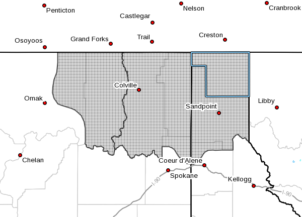 |
The National Weather Service in Spokane has
issued a winter storm watch is in effect from
late Wednesday night through Friday morning for
far north Idaho, including Boundary and Bonner
Counties, and northeast Washington.
Snow Accumulations of five to 10 inches are
possible in the valleys at 2,000 feet to around
2,500 feet; two to five inches are anticipated
at lower elevations along the Columbia River and
State Route 395 between Chewelah and Kettle
Falls, Washington. In the mountains, snowfall
could be from eight to 16 inches.
Snow will increase Thursday morning and become
steady through the day. The heaviest snow
accumulations are expected Thursday night.
Slick travel conditions are expected Thursday as
slushy wet snow accumulates on roads. Roads will
likely become snow covered Thursday night into
Friday morning with travel conditions becoming
treacherous. Backcountry enthusiasts should
expect deteriorating conditions by Thursday
morning. |
|
Questions or comments about this
article?
Click here to e-mail! |
|
|
|
|
