|
Red flag warning in effect this afternoon |
|
August 12, 2017 |
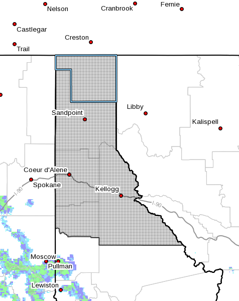 |
The National Weather Service has issued a red
flag warning in effect for North Idaho, as shown
in the map above, from 2 to 11 p.m. today as
isolated thunderstorms are expected to move
across a very dry region at high risk for
wildfire ignition and spread.
Southwest winds of five to ten miles per hour
are expected, with outflow winds from
thunderstorm cells gusting from 20 to 30 miles
per hour. These storms are moving in from
central Washington, and are expected to start
out dry and become wetter later in the
afternoon.
A red flag warning means that critical fire
weather conditions are either occurring now or
will be shortly. A combination of strong winds,
low relative humidity...and warm temperatures
can contribute to extreme fire behavior.
In addition, an air quality alert remains in
effect until noon today due to smoke from
wildfires in Washington, Oregon and Idaho. This
afternoon's winds are expected to help clear
some of the smoke from the region, hopefully
without new fires to produce more. |
|
Questions or comments about this
article?
Click here to e-mail! |
|
|
|
|
