|
Areal flood watch issued |
|
February 14, 2017 |
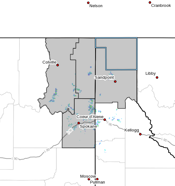 |
The National Weather Service has issued an areal
flood watch for North Idaho and northeast
Washington, in effect from Wednesday evening
through Friday morning.
A wet and mild storm system will spread rain
into the area starting Wednesday afternoon. Rain
will become moderate to heavy at times Wednesday
night and Thursday before tapering off to
showers Thursday night.
Temperatures will warm above freezing Wednesday
and are likely to remain above freezing until
Friday morning.
The combination of rain and melting snow will
increase flows on area rivers and streams
breaking up the current layer of ice. As this
ice moves through river basins, there will be a
threat for flooding associated with any ice jams
that may occur.
In addition, low spots with poor drainage and
clogged storm drains may lead to localized urban
flooding.
Those in low lying areas or in areas prone to
flooding are encouraged to take steps necessary
to protect your property and to secure items
that could float away, potentially damaging
properties downstream.
For those facing flooding problems, Boundary
County has sandbags outside the gate at Road &
Bridge, 73 Sunrise Road at the top of the North
Hill. Sand is available at the county landfill. |
|
Questions or comments about this
article?
Click here to e-mail! |
|
|
|
|
