|
Winter storm warning issued |
|
December 19, 2016 |
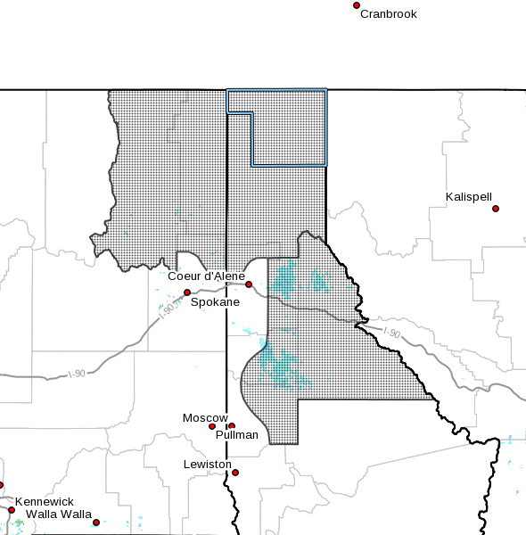 |
The National Weather Service has issued a winter
storm warning for snow, in effect for North
Idaho and northeast Washington from 10 p.m.
today through 10 p.m. Tuesday. A winter storm
warning indicates a very high probability that
severe winter weather is imminent. The winter
storm watch issued Sunday has been cancelled.
A second storm front is expected to roll in
tonight and bring three to six inches of fresh
snow to the valleys and as much as 14 inches to
the mountains. The front will be accompanied by
southwest winds of 15 to 30 miles per hour, with
gusts of up to 50 miles per hour at higher
elevations.
These could combine to make travel extremely
difficult, especially at higher elevations and
during the Tuesday morning commute.
Snow showers are expected to continue through
Tuesday at higher elevations; snow could turn to
rain in the valleys making road conditions wet,
slushy and slick. Temperatures rising above
freezing are expected in the afternoons in the
Bonners Ferry area through Saturday, with
temperatures dropping back below freezing as the
sun sets. |
|
Questions or comments about this
article?
Click here to e-mail! |
|
|
|
|
